I have a large collection of thematic atlases, about a hundred or so of them, mostly on different historical themes. Now, for the first time, I’m acknowledged in one.
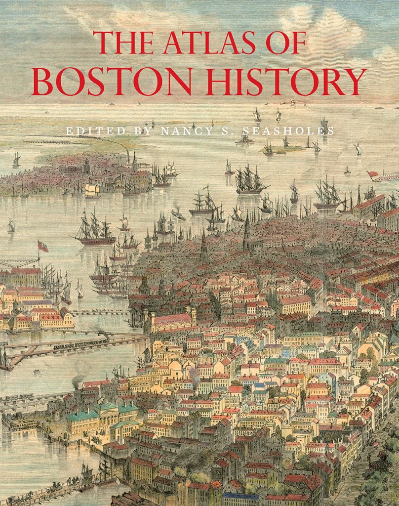
It’s The Atlas of Boston History, edited by Nancy S. Seasholes and published by the University of Chicago Press in 2019.
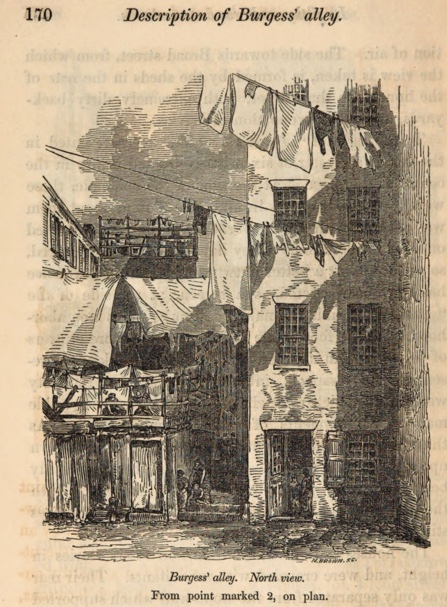
My contribution is a minor one: on Plate 20, Irish Immigration, 1700s-1855, there an image of Burgess Alley, an Irish tenement in the Fort Hill section of Boston. It’s from an 1849 report on cholera in Boston. The late Ruth-Ann Harris, a professor of Irish Studies at Boston College who contributed that section of the atlas, was looking for a tenement image and I pointed her to this one. (I can’t say exactly when that was, but it was a long time ago; Ruth-Ann died in 2012, the same year I left the BC Libraries.)
This atlas, by the way, is a terrific one. The maps are excellent. The text is concise and nicely integrated with the maps. Illustrations are carefully chosen. All elements work together to provide a narrative on Boston themes ranging from exploration to immigration to economy, ethnicity, politics, culture, infrastructure and more.
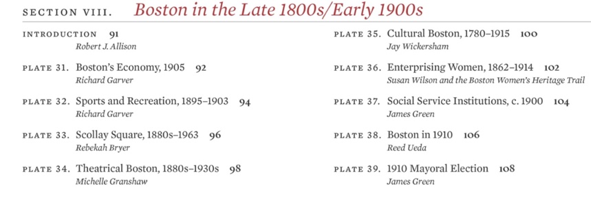
Here, for example, is what’s covered in just one section of the atlas, with nine of the 57 plates and accompanying text and illustrations.
I’ve long been intrigued by thematic maps and atlases. I think of them as an example of what I call “non-verbal narrative,” although they can include verbal elements on the maps themselves, their legends, or accompanying text. (Baseball statistics and baseball cards are another example I have a personal connection to, but that will have to wait for another post.)
The maps, individually and collectively, tell stories of time and place, of people and societies, each with a particular focus.
My collection of historical atlases began with a 1974 printing of the ninth edition of Shepherd’s Historical Atlas, a fairly Eurocentric book first published by William R. Shepherd in 1911. (You can view the maps from both the 1911 and 1923 editions online via the Perry-Castañeda Library Map Collection of the University of Texas Libraries.)
And now I have one with my name in it.